
The Regional Commission is partnering with the New River Valley Metropolitan Planning Organization (MPO) to develop a Regional Freight Plan. In October, the MPO’s Technical Advisory Committee utilized visualizations prepared by the Commission to identify the critical regional freight corridors. The corridors reflect the key roadways that support the New River Valley’s employment centers generating the largest tonnage, highest value, and most in-bound/out-bound trips.
The Commission utilized national data publicly available through the Federal Highway Administration and state/local data made available through the Virginia Department of Transportation and the Department of Rail and Public Transportation. After receiving permission to utilize the information, the Commission synthesized the data sets and met with local economic development professionals to identify and verify the largest sectors contributing to freight generation in the region.
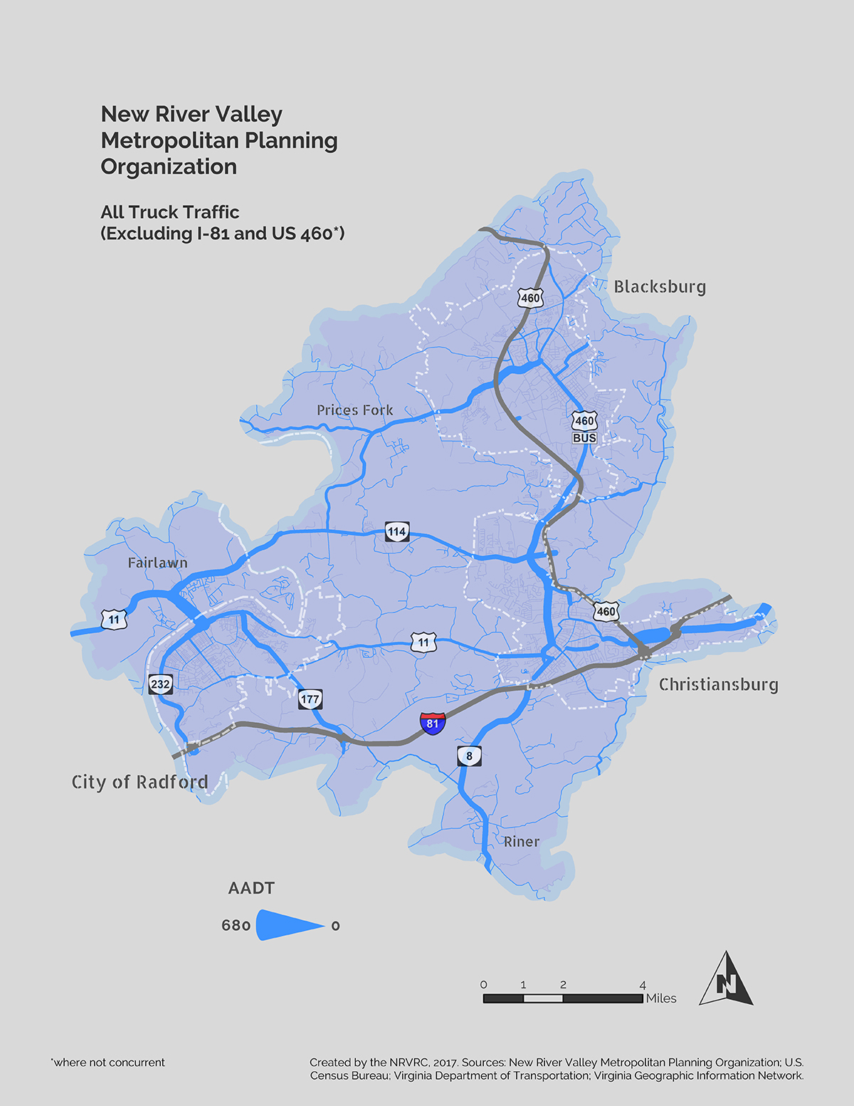
[As an example, the visualization (here) shows the busiest regional networks by using a heavier/thicker line wight for roads with more traffic.] This illustration was used in combination with an interactive map that showed Top 10 freight generators in each County and City by tonnage, value, and trips.
For further information contact Elijah Sharp (esharp@nrvrc.org), (540) 639-9313, ext. 210.